Kudavasal Fm
Type Locality and Naming
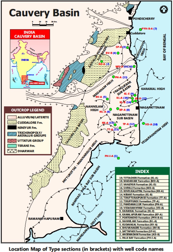
SUBSURFACE: The type section is located at exploratory Well Kudavasal-A (depth interval: 2615-1660 m), in the Tranquebar subbasin. The hypostratotype is in the well Bhuvanagiri-B (depth interval: 3365-2330 m). It was named after the Kudavasal village by ONGC team steered by Venkatarengan et al., (1993) and issued as Document-VII by KDMIPE, ONGC, Dehradun (1993).
[Figure 1: Type-section Map of Subsurface Formations]
Lithology and Thickness
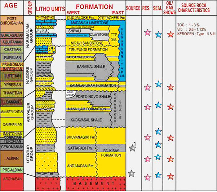
Sandy claystone. This formation consists of shale/calcareous silty shale with occasional calcareous sandstone bands. The calcareous shale is micaceous, hard, massive, moderately fissile. The calcareous sandstone is dirty white to light gray, fine to medium grained, subrounded. Its thickness varies from 955-1035 m. Part of Ariyalur Gr.
[Figure 2: Generalized Stratigraphy and Petroleum System of Cauvery Basin (from dghindia.gov.in)]
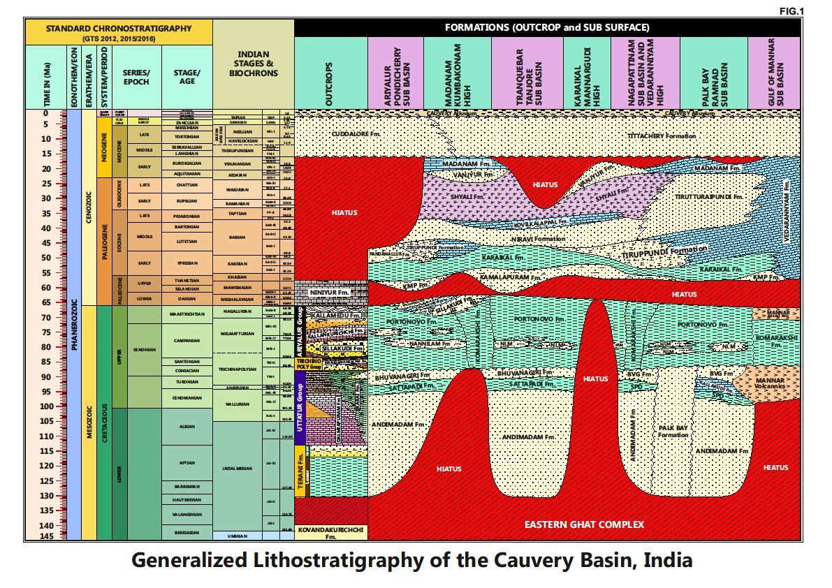
[Figure 3: Generalized Stratigraphy of Cauvery Basin (Provided by A. Nallapa Reddy & R. Nagendra)]
Relationships and Distribution
Lower contact
Unconformable with the Bhuvanagiri Fm.
Upper contact
Conformable with the Nannilam Fm.
Regional extent
Present all along the eastern part of the basin. Its lithological extension not found in the outcrops.
GeoJSON
Fossils
Characteristic Planktonic foraminifera are Dicarinella asymmetrical, Marginotruncana pseudolinneiana, M. coronata, and M. renzi.
Age
Depositional setting
Outer neritic-Upper bathyal.
Additional Information
It is partly equivalent (biostratigraphicly) to the exposed Sillakkudi Fm in the outcrops.


